Our Research
Our research integrates elements of machine learning, pattern recognition, and signal processing, with their applications in remote sensing image interpretation, smart agriculture, and smart city development.
Have a look at a popular science video about our research on developing secure control systems. You can also find some of our recent research themes described at the end of this page.
Demos
Selected research themes
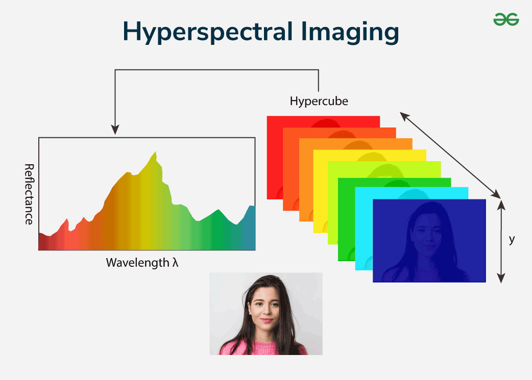
Hyperspectral Computer Vision
Computer Vision refers to using cameras and computers to replace human eyes for processing, recognizing, tracking, and measuring targets. Current computer vision research mainly relies on spatial structural information of the targets, while neglecting the rich physical material properties contained in the spectral dimension of the targets. This leads to failures in complex scenarios such as small targets and background interference. Hyperspectral imaging technology transcends the morphological structural characteristics of targets by comprehensively utilizing detailed spectral information and spatial information obtained by imaging spectrometers, providing more physical material information conducive to target recognition and localization. With the advent of low-cost hyperspectral video cameras, vision research based on hyperspectral data has become more feasible and practical, also providing important tools to overcome the application limitations of computer vision in specific fields such as agriculture and defense. Hyperspectral Vision combines the spatial structural characteristics and physical material information of targets for perception, recognition, and understanding, but faces challenges such as complex physical modeling of hyperspectral imaging environments, low spatial resolution with complex feature extraction, and a lack of dynamic analysis due to insufficient video data.
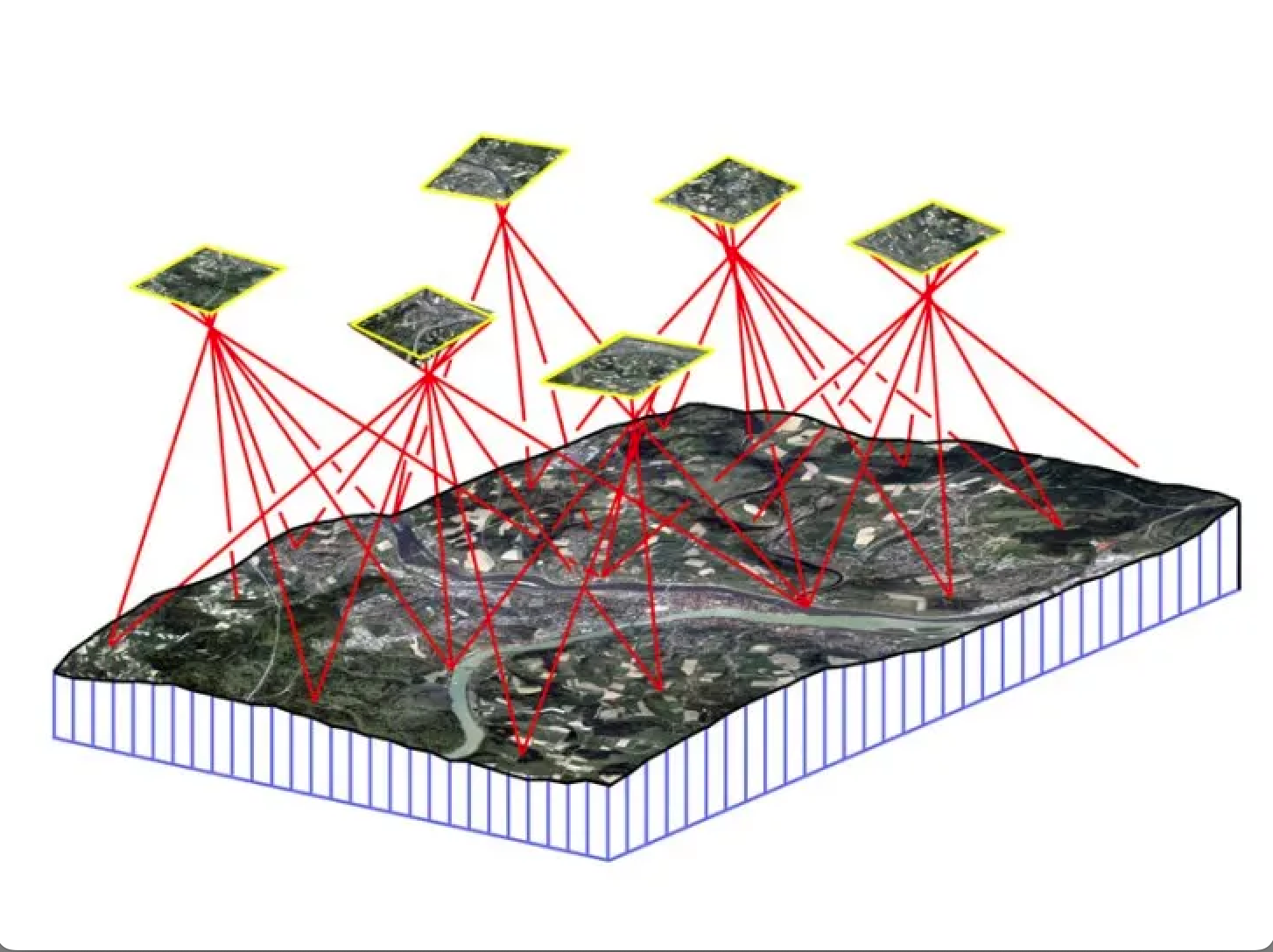
Remote Sensing Image Interpretation
Remote sensing images indeed offer an expansive view of the Earth, enabling us to observe and analyze various environmental and geographical phenomena. Remote sensing images can be captured from various platforms, including drones, satellites, and aircraft. Each platform offers different perspectives and resolutions, making it possible to monitor both large-scale and localized changes. By leveraging machine learning techniques to interpret these images, we can gain valuable insights into Earth’s behavior and respond effectively to unexpected events. Currently, our group mainly focus on remote sensing change detection task which aims to identify surface changes from bitemporal images, is significant for many applications, such as environmental protection and disaster monitoring.